
In the compilation of maps below we see a map of the contiguous United States used as a reference for explaining the relative size and location of other places in the world (and solar system).
If you enjoy this quirky compilation be sure to check out our more extensive posts:
– 40 Maps That Will Help You Make Sense of the World
– 32 Maps That Will Teach You Something New About the World
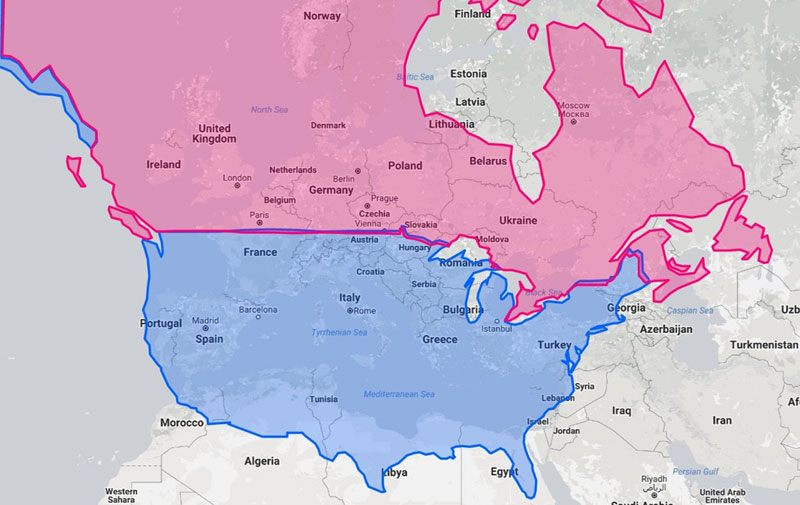
1. If the Mediterranean Sea was in North America

Map by GappyJostar on reddit
2. The United States and Canada at the Same Latitudes as Europe
Map by UltraWorlds on reddit
3. If the World’s Population* Lived in One City (data from 2011)
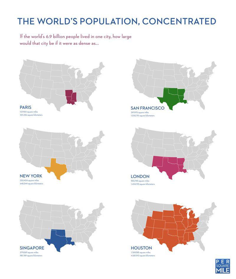
Map by Tim De Chant/Per Square Mile
4. Using Colorado to Show How the Mercator Projection Skews Size from the Equator to North Pole
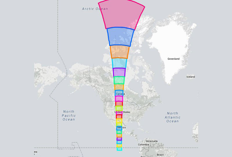
Map by h2ppyme using The True Size Of…
5. US/North America on the Surfaces of the Moon, Mars and Jupiter
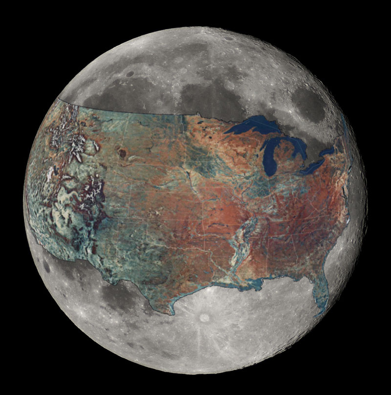
Map by boredboarder8 on reddit
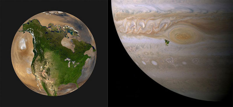
Map by John Brady/Astronomy Central


