


Created by MapMakerDavid
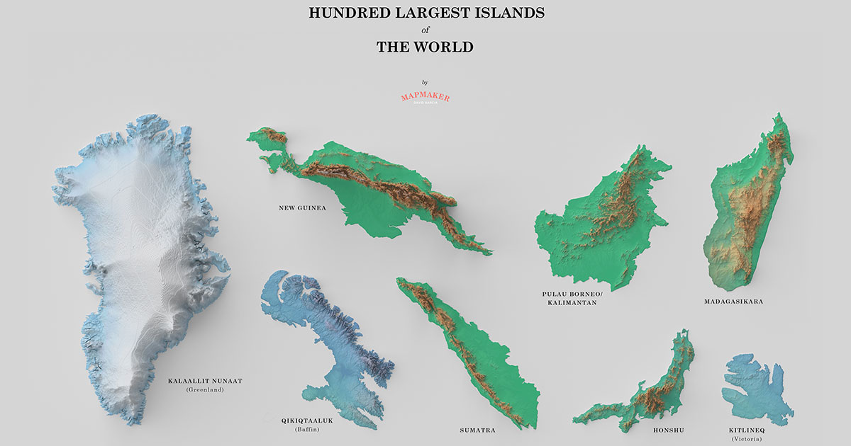
In this cool visual by MapMakerDavid, we see a poster of the 100 largest islands in the world.
On reddit, where I came across the map, David says he used QGIS and Blender with calculations made using the Equal Earth Projection digital elevation model from NASA Island shapes.
He also attributes Daniel Huffman for the original relief shading method and hypsometric tint from Natural Earth.
To see the full resolution 3507 x 4960 pixel poster, click here or simply click the poster above 🙂
Article Categories:
art · comparison · DESIGN · geography · infographic · largest · maps · NATURE/SPACE · posters · TRAVEL · visualization


