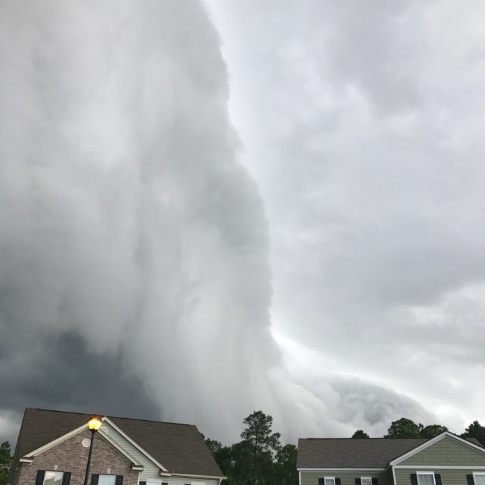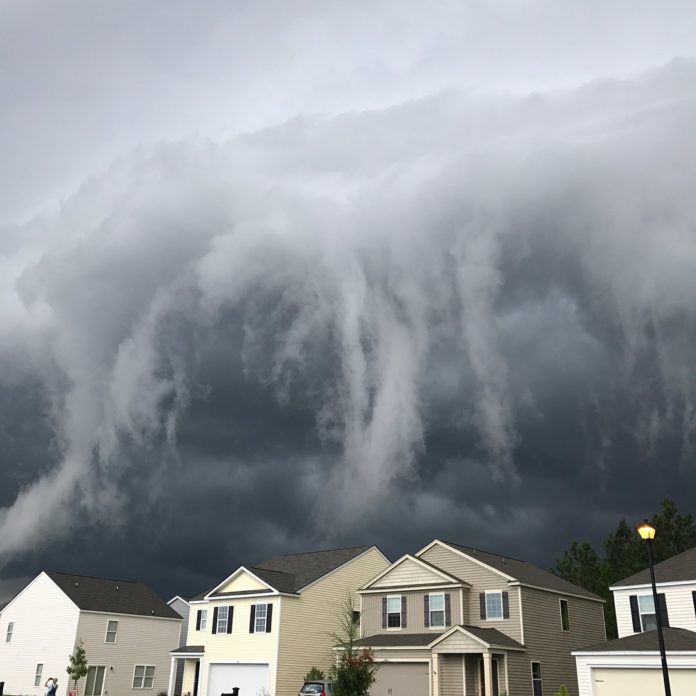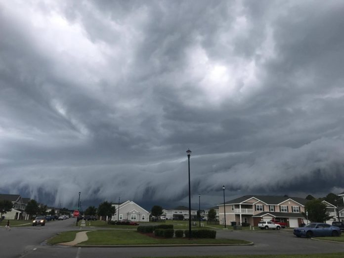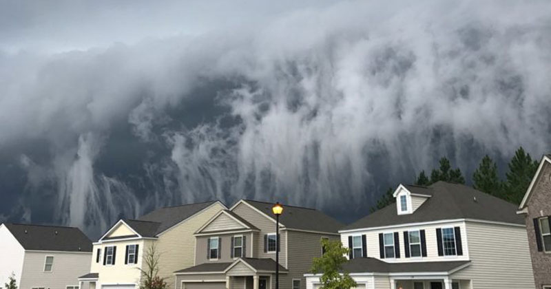
An ominous storm cloud was recently sighted over Hinesville, Georgia on August 31st and it looked like an incoming sky tsunami. Local resident and photographer Johanna Hood took some amazing photos and videos of the incredible shelf cloud, which is typically a precursor to a big thunderstorm.
[via Johanna Hood on Instagram]
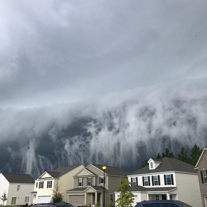
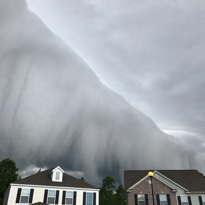
A shelf cloud is a low, horizontal, wedge-shaped arcus cloud. A shelf cloud is attached to the base of the parent cloud, which is usually a thunderstorm, but could form on any type of convective clouds. Rising cloud motion often can be seen in the leading (outer) part of the shelf cloud, while the underside often appears turbulent and wind-torn. Cool, sinking air from a storm cloud’s downdraft spreads out across the land surface, with the leading edge called a gust front. This outflow cuts under warm air being drawn into the storm’s updraft. As the lower cooler air lifts the warm moist air, its water condenses, creating a cloud which often rolls with the different winds above and below (wind shear). [source]